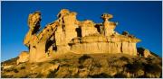
 Category: Rock-formation
Location: municipality Malaga »
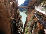
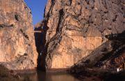
Years ago the Caminito del Rey (Malaga municipality) was a dangerous path not so popular beyond borders of Andalusian region, but after the recent restoration and reopening it was made more safe. There are amazing views of the Guadalhorce dam and suspension bridge over 100 meters deserve....
 English (en)
 Deutsch (de)
 Русский (ru)
 Français (fr)
 Español (es)
 Български (bg)
 Português (pt)
 日本の (jp)
 한국의 (kr)
 中國的 (cn)
 Nederlands (nl)
 Italiano (it)